
Sudbury Basin · Ontario, Canada
Brady Sudbury Project
Open File Report 6391
Base, Critical, and Precious Metals Mineralization in the Metasomatic Iron and Alkali-Calcic Systems of the Southern Province in the Sudbury Area
This geological guidebook describes how sodium-rich fluids altered rocks across the Sudbury region, some of which host gold and copper mineralization. Adelphi has reported comparable features at Brady, including sodium-enriched rocks with gold, copper and iron enrichment, and these are central to the exploration model its geologists are now testing on the property.
Read the Report (PDF)Brady Sudbury Project
Brady’s Sudbury Setting
Under the option agreement announced March 3, 2026, Adelphi may earn a 100% interest by meeting cash, share and exploration commitments over three years.
See the October results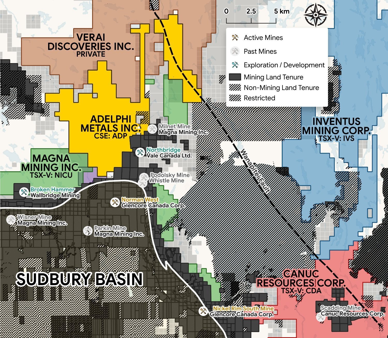 The Brady Sudbury Project within the Sudbury Basin and its neighbouring deposits
Sudbury Location
On the northeast edge of the Sudbury Basin.
Project Footprint
Claim groups covering a total area of 8,811 ha.
Access
Road access in place.
Mineralization on neighbouring or adjacent properties is not necessarily indicative of mineralization on the Brady Project.
The Exploration Model
Testing a Fault-Controlled System
Adelphi interprets the showings across Brady as possible surface expressions of one interconnected, fault-driven system. Its exploration model is iron oxide copper-gold (IOCG): a type of mineral system in which iron-rich rocks can occur with copper and gold. Fieldwork and planned surveys are designed to test that model, not assume it is proven.
Adelphi's Geological Interpretation
-
1
The Fault
The Company views the Wanapitei Fault as a potential link between showings across Brady.
-
2
The Splays
Branches of the fault and contacts between rock types may have provided pathways for mineralizing fluids. This is part of the model being tested.
-
3
The Comparable
The Wanapitei Fault follows the same trend as the fault interpreted to control the past-producing Scadding mine. Nearby mineralization does not establish what is present at Brady.
-
The Opportunity
Combine field observations, assays and geophysics to identify priority areas for further exploration. The IOCG model remains conceptual.
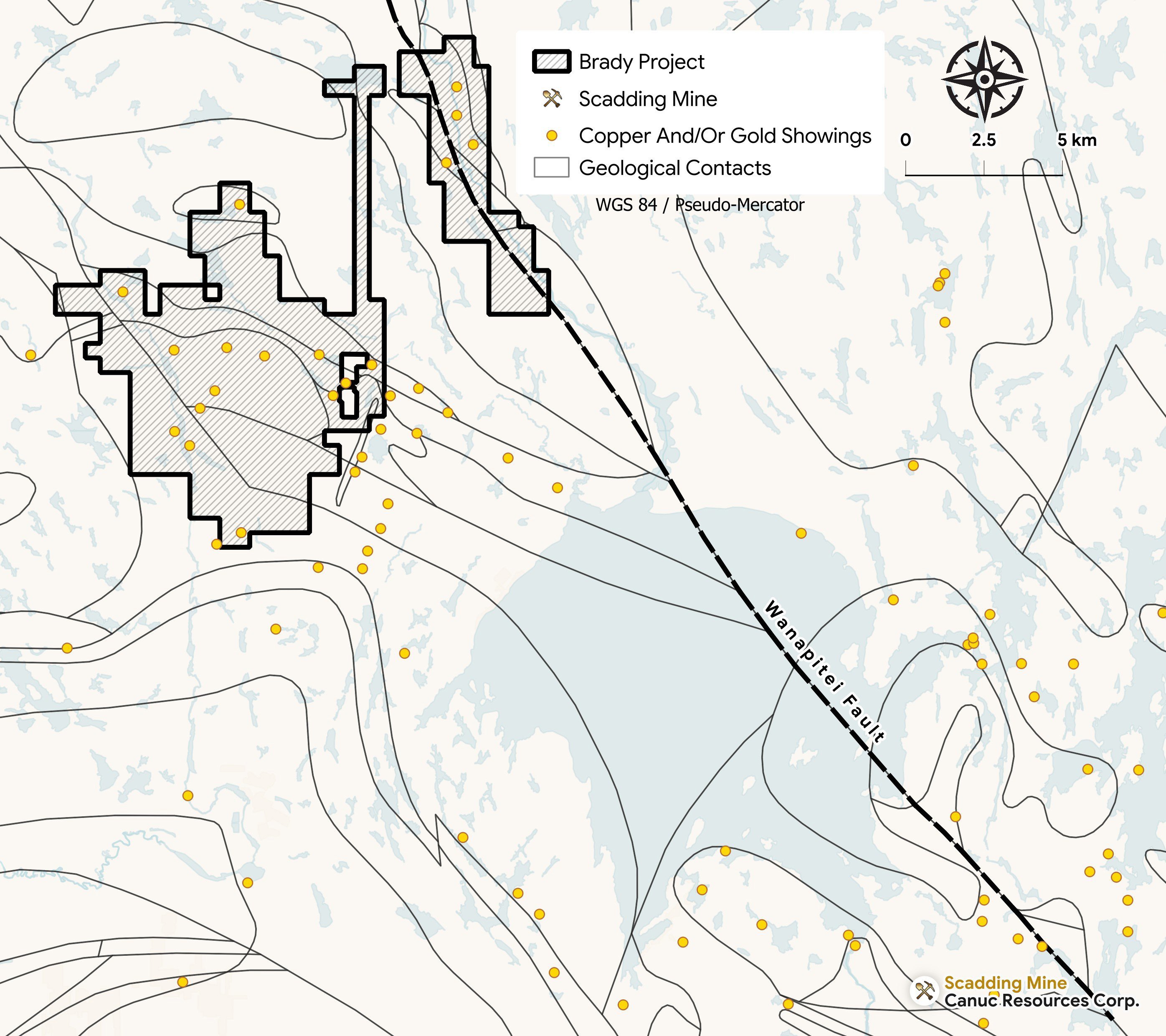 The Wanapitei Fault, projecting south into the Scadding Mine
Exploration Targets
Exploring the Brady Targets
Historical results are context for exploration, not estimates of average grade. As qualified in the July 24, 2026 release, historical results compiled from prior operators and public records have not been independently verified by Adelphi. Grab and select samples are selective and may not represent a zone's true or average grade.
North River Target
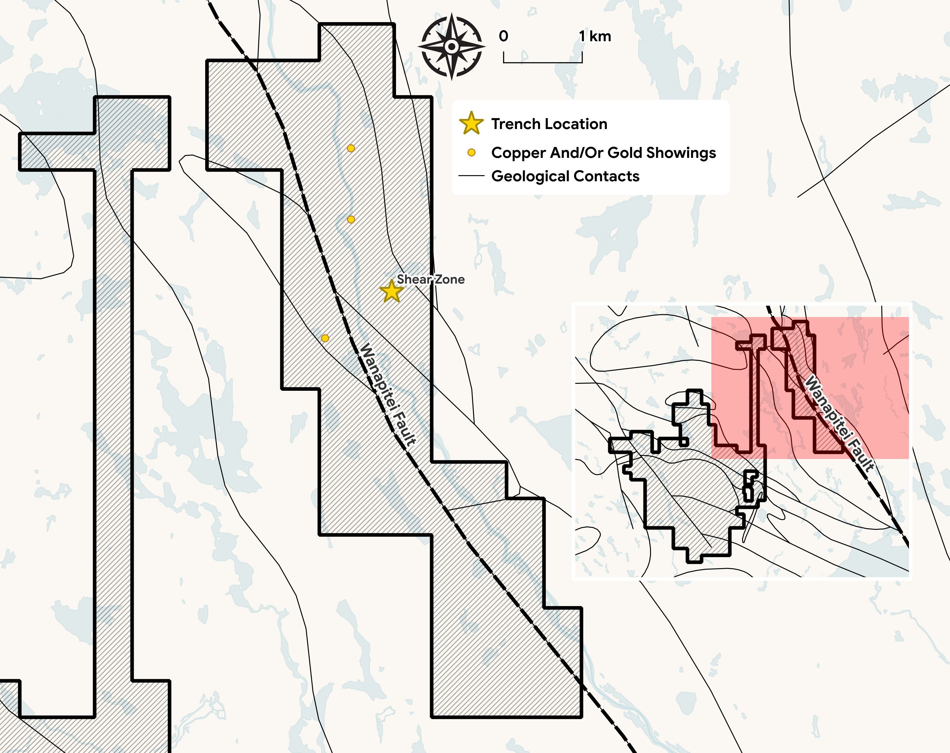
A 6 m shear zone — the Malachite Showing — sits directly on the Wanapitei Fault, where the 2023 trench ended before the mineralization did.
- Iron-rich throughout — Fe to 9.9%, with 2,000–10,000 ppm Cu and 0.5–3 g/t Au. The planned ground gravity survey is intended to test whether dense, iron-rich bodies are present at depth.
- Adelphi interprets the Wanapitei Fault as following the same trend as the fault interpreted to control the past-producing Scadding mine. This regional comparison supports an exploration model, not a prediction of equivalent mineralization.
- At North River, bedrock samples returned up to 0.72 g/t gold with 0.14% copper, and two mineralized boulders, whose bedrock source is yet to be traced, returned 1.71 g/t gold and 1.28 g/t gold with 1.76% copper.
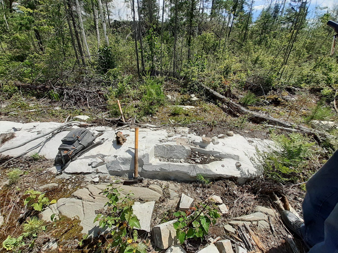
Gold on the Contact
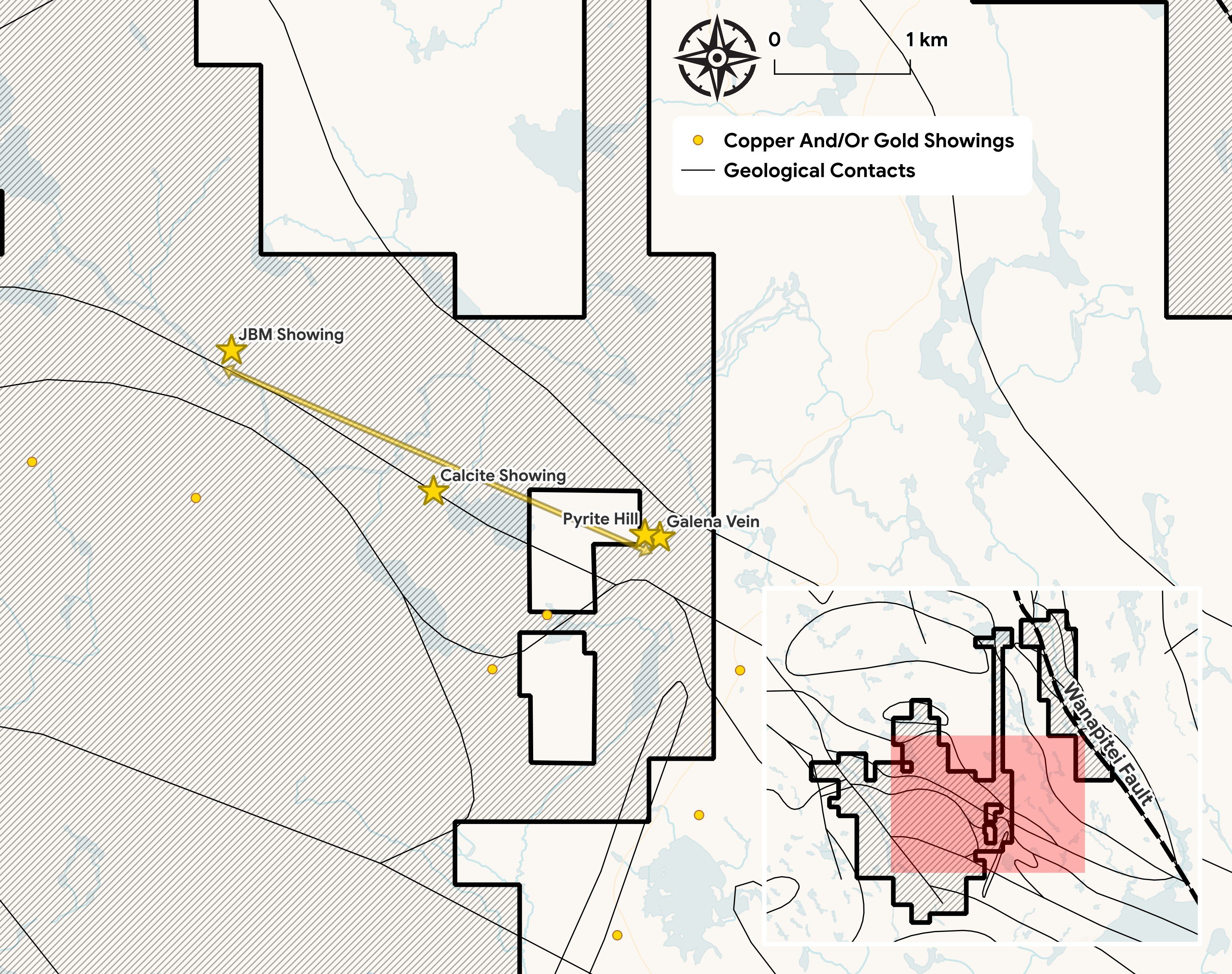
Four gold-copper-silver showings (Pyrite Hill/Galena, Calcite, JBM, McFie Lake) align along a 6 km NW corridor. A continuous 4 km IP chargeability anomaly links them, is open in both directions, and has never been drilled.
Pyrite Hill / Galena
High-grade gold at surface, directly over the untested IP anomaly on the contact. Historical select surface grab: 16.85 g/t Au, 28.8 g/t Ag, 0.59% Cu — with tellurium, a gold-system pathfinder, confirmed at surface.
The March 3, 2026 release reports that two of three 2021 Galena/Pyrite Hill drill holes intersected gold. A later review found the holes were not optimally located; additional drilling was recommended but had not been completed.
Golden Pine
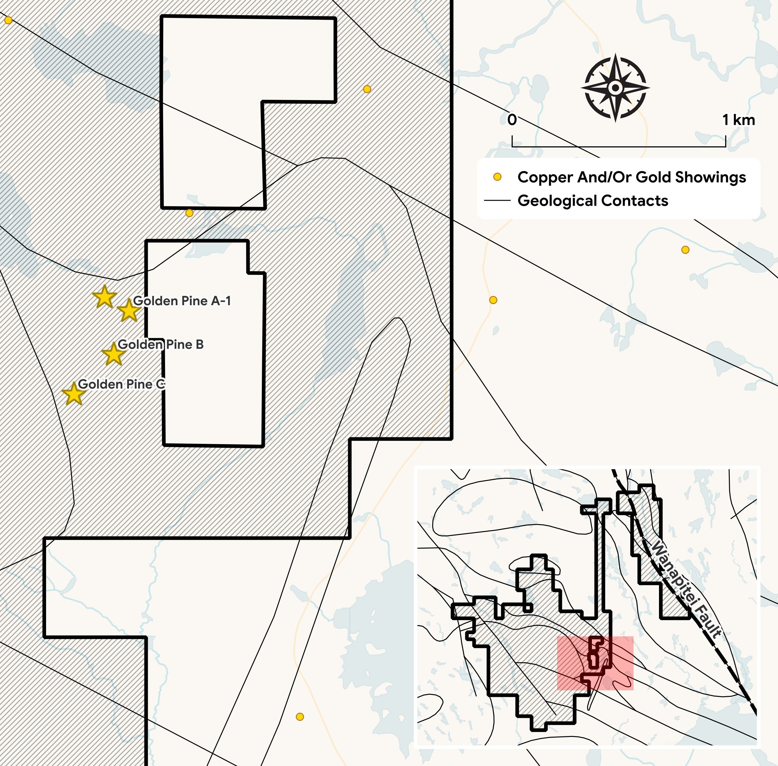
Historical work at Golden Pine identified four subparallel gold-bearing zones within a shear system. Adelphi is evaluating these showings as part of its broader fault-controlled exploration model.
- A ~150 m wide shear system in altered felsic volcanic rocks with up to 40% disseminated pyrite — four subparallel zones identified by historical work.
- A 1 km IP anomaly extension to the northeast has never been drill-tested.
Exploration Results · October 22, 2026
High-Grade Surface Gold
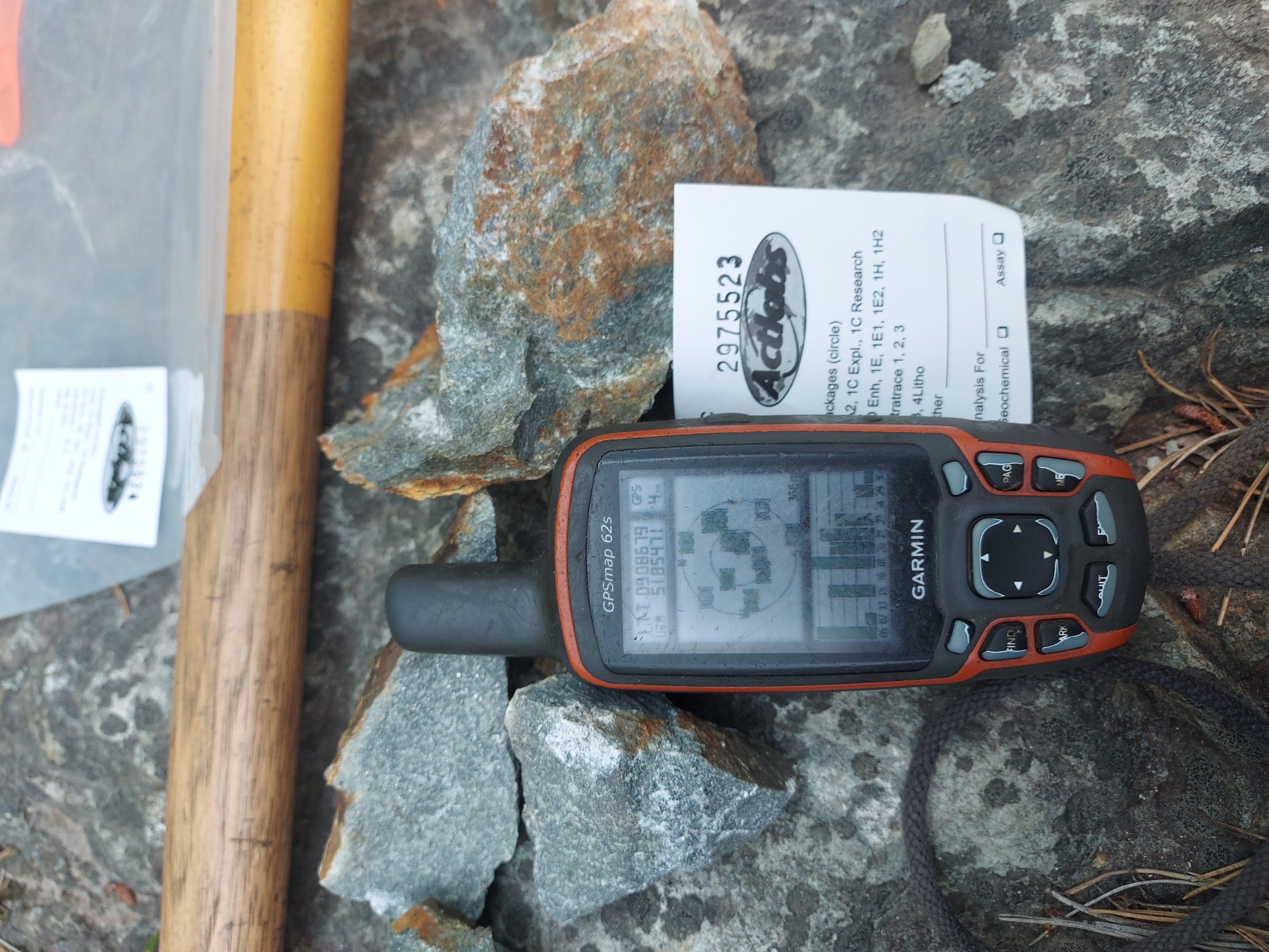
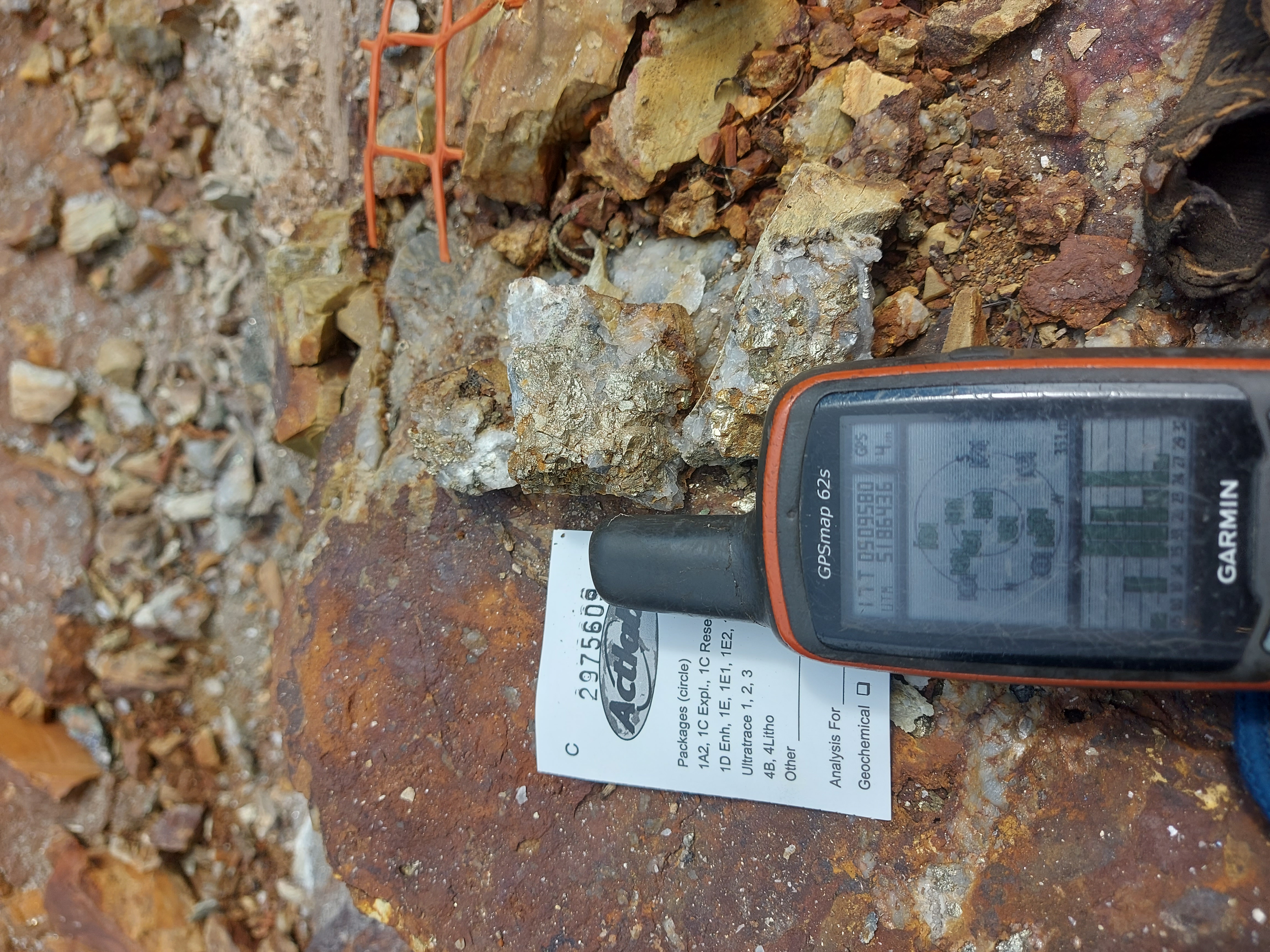
The program identified high-grade surface gold at Golden Pine and Marble Mountain, sodium-enriched rocks and a metal signature consistent with the Company’s iron-rich, fault-controlled exploration model.
High-Grade Gold
Gold values ranged from below detection up to 53.9 g/t, highlighted by five bedrock grab samples returning final values of 53.9, 49.7 and 37.0 g/t gold at Golden Pine, and 49.2 and 46.7 g/t at the Galena Vein in the Marble Mountain corridor.
Two additional Galena Vein bedrock samples exceeded 30 g/t gold by fire assay; metallic screen results are pending.
Sodium Enrichment
Six samples returned 6.0% to 8.2% Na₂O and less than 1% K₂O, consistent with an albitite-like composition. Petrographic confirmation has not been completed.
Associated Metals
Gold-bearing samples show iron enrichment and locally elevated cobalt, tellurium, bismuth and rare earth elements. Reported values include up to 587 ppm cobalt, 124 ppm tellurium and 931 ppm bismuth.
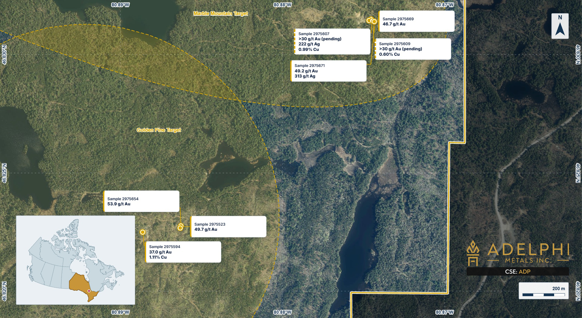
Adelphi interprets the 2026 results as following the structure of the Wanapitei Fault system. The high-grade gold at Golden Pine and Marble Mountain sits on faults branching from the Wanapitei Fault, while copper is concentrated on the main fault at North River, which accounted for 11 of the 20 samples on the property returning 0.1% copper or better.
Next Steps · As Reported October 22, 2026
- 1
Ground Gravity Survey
a ground gravity survey at North River to test for a dense, iron-rich body at depth
- 2
Airborne Electromagnetic Survey
an airborne electromagnetic (VTEM) survey over the Marble Mountain corridor to map the sulphide zones that carry the gold.
- 3
Define Drill Targets
The results will be combined with follow-up structural mapping, channel sampling and historical induced polarization data to define drill targets, including along the 4 km geophysical anomaly in the Marble Mountain corridor, which has never been drill tested, for a maiden drill program at Brady.
Readers are cautioned that the rock samples reported in this news release are grab and select samples, which are selective by nature and may not represent true grades or the average grade of any zone, and that boulder samples are not in place and their bedrock source is unknown. Values reported as exceeding an upper detection limit are minimum values pending re-assay. The identification of sodic alteration is based on whole-rock geochemistry and visual observation and has not been confirmed by petrographic analysis.
references to the Scadding mine, the Alwyn prospect and to deposits elsewhere in Canada are provided for geological context only, and mineralization on a neighbouring or nearby property is not necessarily indicative of mineralization on the Company's property. There has been insufficient exploration to define a mineral resource on the property, and no economic mineralization has been demonstrated.
Qualified Person · October 22, 2026 News Release. The technical elements of this news release have been reviewed and approved by Mr. François Gagnon, P.Geo., a Qualified Person and Independent Consultant to the Company, as defined under National Instrument 43-101.